We arrived in Danang last night after a long flight to Inchon and then on to Danang. Jim’s idea of flying business class turned out to be a good one. Our seats were very spacious and the food was good. We certainly arrived in better shape than we would have if we had traveled coach. This morning we packed up the GPS, some old photographs and some maps and we took our Vietnamese driver on an adventure. It is very frustrating to know exactly where you want to go and to try to get a driver, whose command of English is tenuous at best, to follow your directions. I won’t even get in to what it is like to ride in a car over here. I did enough of that in the blog from my last trip. Anyway, after some twists and turns we managed to get within a few hundred feet of our first battery position.
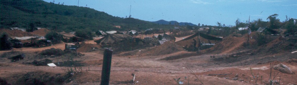
During our first reunion in 2014 Jim spoke about our “first” position in Danang and our “second” position. John, Henry, and I told him he was crazy because we never remembered any “second” position. Bert settled the argument by agreeing with Jim that we had been in one position for a very short time (it turned out to be less than three weeks) and then we moved to a second position, which we occupied until June 1966, when we moved up to Gia Le by Rough Rider convoy up Route 1 and over the Hai Van Pass. I went back to my pictures after he brought it up and found clear evidence that we had, in fact, been in two different but relatively close positions. The problem with finding these places is that much has happened to change their appearance in the intervening 50 years. Our fist position was a nice grassy area that even had some trees on it. The place is now surrounded by a light industrial park and the exact location of what had been our position is now a dump or a landfill. Anyway we got pretty close as the photo below shows.
My first attempt back in 2011 to locate the second battery location was not very successful for a few reasons. First, my GPS location was off by about 500 meters due to a discrepancy I found between the military grid system and the modern grid system used by modern GPSs. I created a work-around that allowed us to use the coordinates from the old records and correct them using graphic overlays. GPS technology has also improved and now we are able to use both the American and the Russian GPS satellite systems to get very precise locations. Despite that, the site of our second position had been part of a quarry and is now occupied by a Cement/Sand and Gravel company and any landmarks have been obliterated. We got within 500 feet of the Battery Center but we couldn’t document it because there are no landmarks to use to document it. You’ll just have to take our word for it.
As for the third location I planned to visit today, the site of the last Battery Center we had in Vietnam in 1970, it is in the center of a very densely populated area and we didn’t even attempt to locate it. We did come within 0.28 miles of it though according to the GPS.
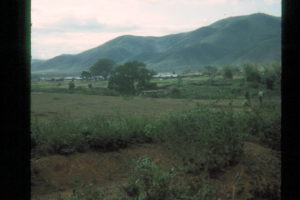
I was amazed in 2011 by how much this place had changed. In the 1960’s this area was a very rural area near a big town (Danang). Now Danang has changed even more to become a bona fide “metroplex” that extends for miles in all directions from a glitzy little city full of high-rise apartment buildings and condo’s. It was very obvious as the plane approached the city last night as to how big it had grown.
But the people are friendly. The prices are cheap. It cost me about $10 today for two beers, a salad and a bowl of noodle soup. The weather has been good with relatively mild temps (~82°) but very high humidity. For some reason I have not been bothered by jet lag and my digestive system is cooperating. Tomorrow we head south to visit Hoi An and then to find three locations down there (Hill 55, Hill 65, and the An Hoa Combat base).
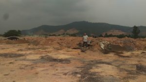
1st BC – 2011
1st BC – 1966